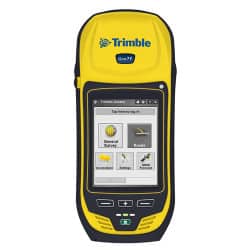
Manufacturer: Trimble
Part Number: Geo 7X
Order / Quote
Designed for High Efficiency Work The Trimble Geo 7X is fully rugged with an IP65 rating for dust and water, and MIL-STD-810F ratings for drops, shock, vibration, temperature, altitude and humidity.
The Trimble Geo 7X with Access software and services, together with Trimble VRS technology and Trimble Business Center, is an optimal solution for surveyors facing a variety of work requirements.
For times when occupying the position is simply not possible due to dangerous conditions or right of-way challenges, utilize the detachable Geo 7X rangefinder accessory. Measurements integrate directly into Trimble data collection software—simply point and shoot to get the position.
Optimized with Trimble Access Software Trimble Access field software features the power, functionality, and modularity that surveyors need today. It is designed to support everyday work – topographic surveys, staking, control, and more – through a familiar, easy-to-use interface that will ensure your instant productivity— and you’ll experience less of the typical downtime associated with learning new software.
The integrated 3G cellular modem allows continuous network and internet access for web-based services, Trimble VRS corrections, and live, secure synchronization of field and office files through Trimble AccessSync.
In addition, wireless connectivity options including cellular and Wi-Fi technology ensure that field workers can remain in contact with the office and each other, even from remote locations.
The Trimble Geo 7X comes with Microsoft® Windows® Embedded Handheld version 6.5 Professional operating system, making it easy to use standard office documents in the field.
Photographs and Geotagging in the Field Aiding in capturing information about an asset, event, or site, the Geo 7X includes a 5 megapixel autofocus camera with geotagging capability. The camera is controlled by the Trimble Access software, so photo capture and linking of images to survey data is seamless and simple to integrate with existing workflows.
Easily record the qualitative information that survey data alone can miss, such as site conditions or work progress. The benefits of including images as part of your workflow are almost limitless – from easy data handover to in-field quality assurance.
• Dual-frequency GNSS receiver and antenna with Trimble R-Track™ technology
• Sunlight readable 4.2” polarized display
• Integrated 3.5G cellular modem • Integrated Wi-Fi and Bluetooth® wireless technology
• 5 megapixel auto-focus camera
• Microsoft® Windows® Embedded Handheld version 6.5 Professional.
• Rugged and water-resistant design
• Trimble R-Track technology
• Advanced Trimble Maxwell™ 6 Custom Survey GNSS chip with 220 channels
• High precision multiple correlator for GNSS pseudorange measurements
• Unfiltered, unsmoothed pseudorange measurements data for low noise, low multipath error, low time domain correlation and high dynamic response
• Very low noise GNSS carrier phase measurements with <1 mm precision in a 1 Hz bandwidth
• Signal-to-Noise ratios reported in dB-Hz • Proven Trimble low elevation tracking technology
• Satellite signals tracked simultaneously: – GPS: L1C/A, L2C, L2E (Trimble method for tracking L2P) – GLONASS: L1C/A, L1P, L2C/A (GLONASS M only), L2P – SBAS1 (WAAS/EGNOS/MSAS): L1C/A
• 1 Hz (positioning), 5 Hz (stakeout) • 1 Hz data storage
• CMR+, CMRx, RTCM 2.1, RTCM 2.3, RTCM 3.0, RTCM 3.1 Input via cellular modem
• Geo 7X handheld with Trimble Access software with Microsoft® Windows® Embedded Handheld version 6.5 Professional.
• Rechargeable battery (x2)
• International AC charger (x2)
• Range pole bracket
• USB Data Cable (mini USB)
• Hand strap
• Stylus pen (x2) and stylus tether
• Screen Protectors (x15)
• Device label pack
• Antenna port dust cover
• Transport case
• Quick Start Guide
• External GNSS antenna with 1.5 m antenna cable